
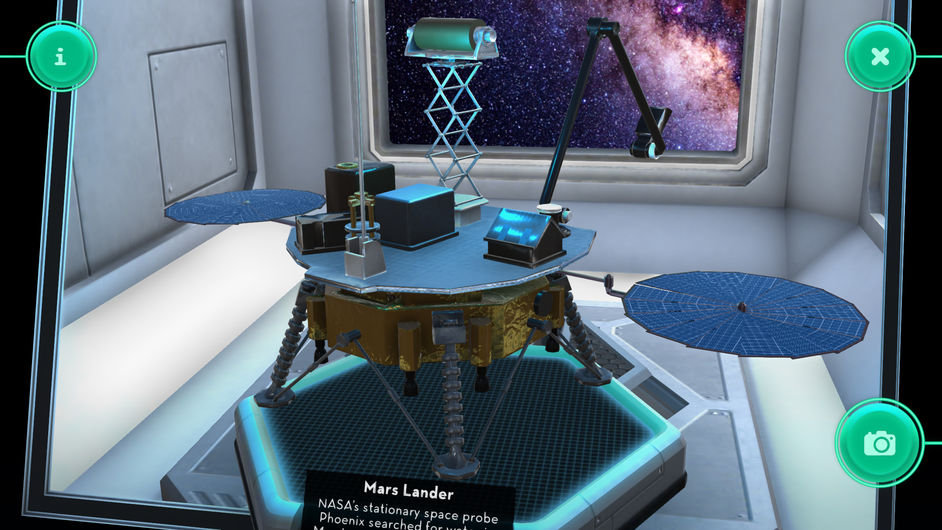
|
Menu |


|
Menu |
Flight and Landing
| For more photos, simply follow Marsty. | |
| For more detailed information, simply follow Cosmo. |
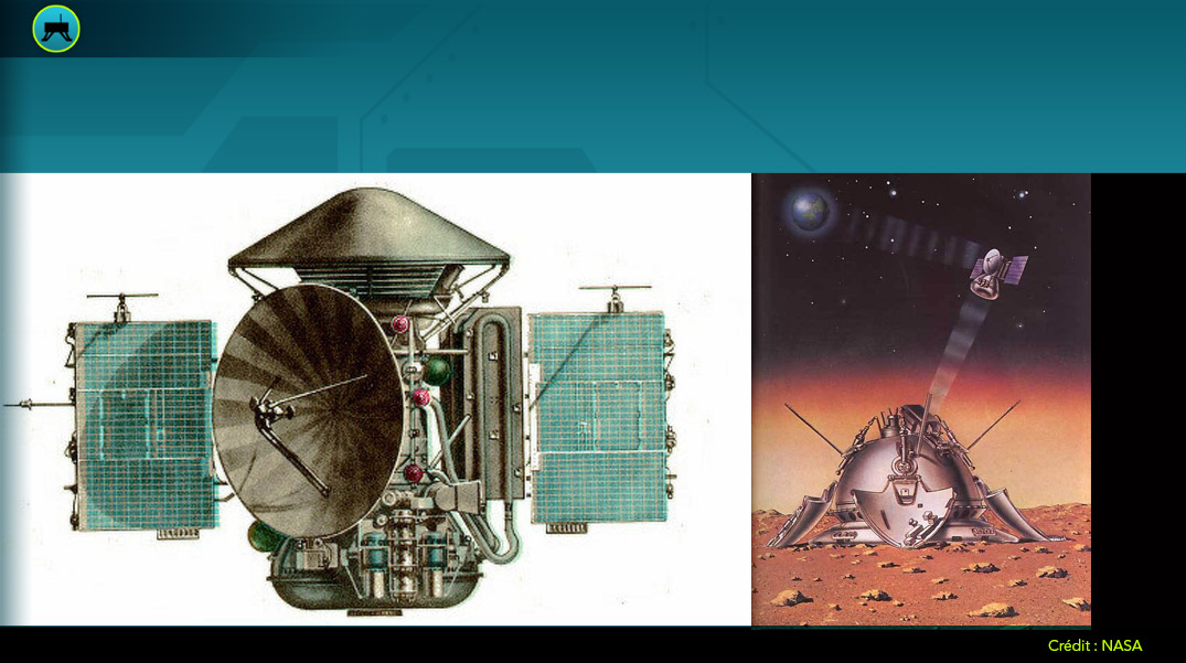
InSight goes into orbit
 InSight on its way to Mars
Take-off successful! WELL DONE!
On launch day, May 5 2018, Mars is 121 million kilometres from Earth. However, due to the relative motion of the planets, the probe has to travel 485 million kilometres to reach the red planet. The InSight probe lands on Mars on November 26, 2018, after a journey lasting six and a half months, or 210 days.
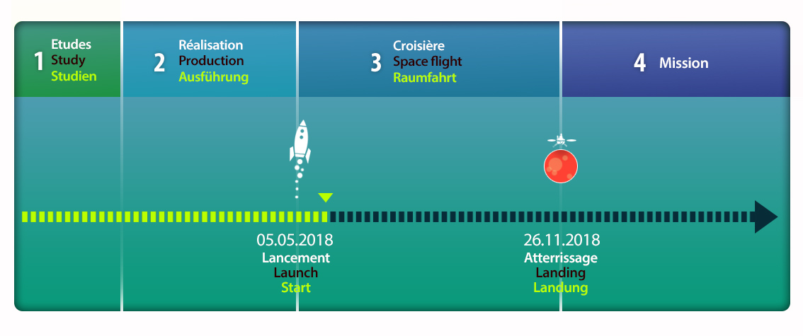
Timeline of the Insight mission (© Arteclick)
InSight probe goes into flightAfter takeoff, there are several steps required to put the probe into orbit and flight towards Mars.
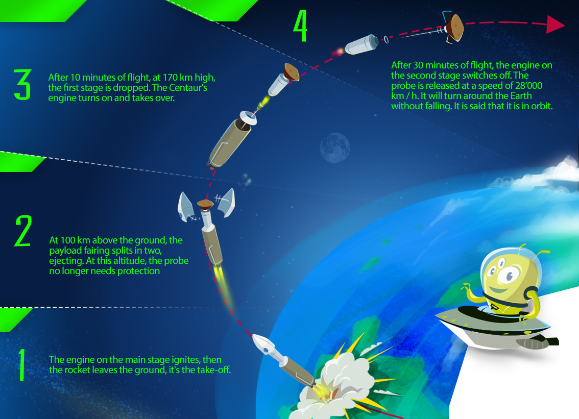
The key stages for placing a craft in Earth orbit (© Arteclick).
After a short vertical ascent, the Atlas V rocket makes a course adjustment towards the south. The first-stage engine burns for 244 seconds and then the booster rocket shuts down. The first stage of the rocket is dropped and falls back into the Pacific Ocean.
Then, the Centaur rocket stage pushes InSight towards Mars.
Finally, 93 minutes after takeoff, InSight is definitely separated from Centaur and begins its journey to Mars.
Seconds later, it’s the turn of the 2 nanosatellites, CubesSats MarCO-A and MarCO-B to be released into space and follow InSight. They were designed to be “radio relays” between InSIght and the ground team on Earth throughout the flight.
InSight cruise to Mars (© NASA).
After InSight is released from the launcher it is moving away from Earth at a speed of 10,000 kilometres per hour (6,200 miles per hour).
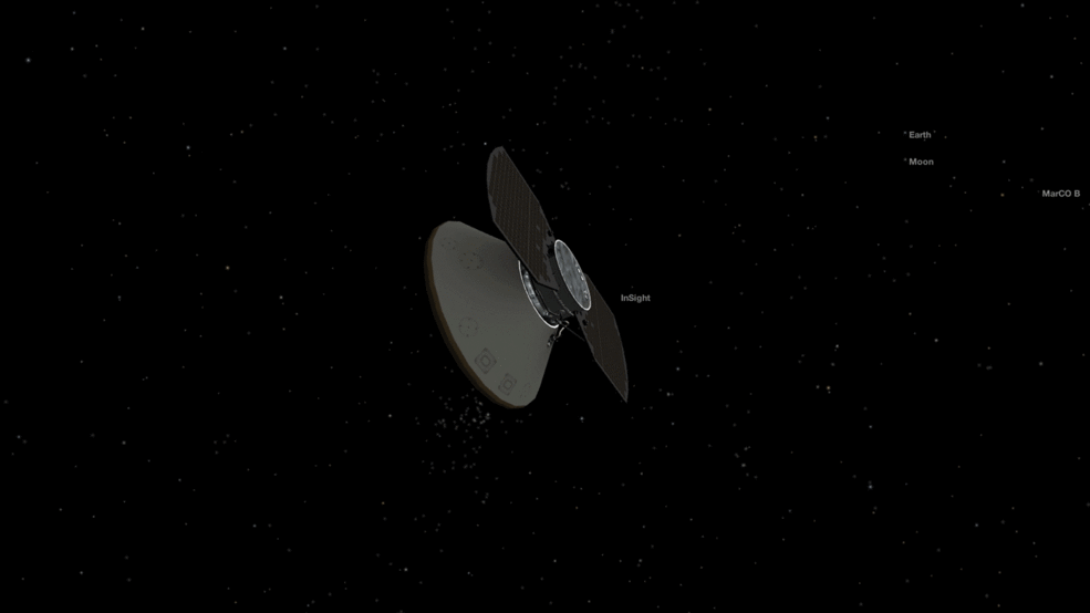
Once InSight is released from its launcher it moves away from Earth at a speed of 10,000 kilometres per hour (© NASA).
The team following the mission from Earth have been piloting InSight almost continuously since launch. They must adjust its trajectory several times during the flight, making sure that InSight is moving at the right speed and in the right direction.
Attitude corrections are required to keep the InSight antenna pointing towards Earth for high quality communications. It is also important to keep the InSight solar panels facing the Sun to preserve its power.
To make these small corrections, the team must be able to communicate with the InSight navigation instruments at all times.
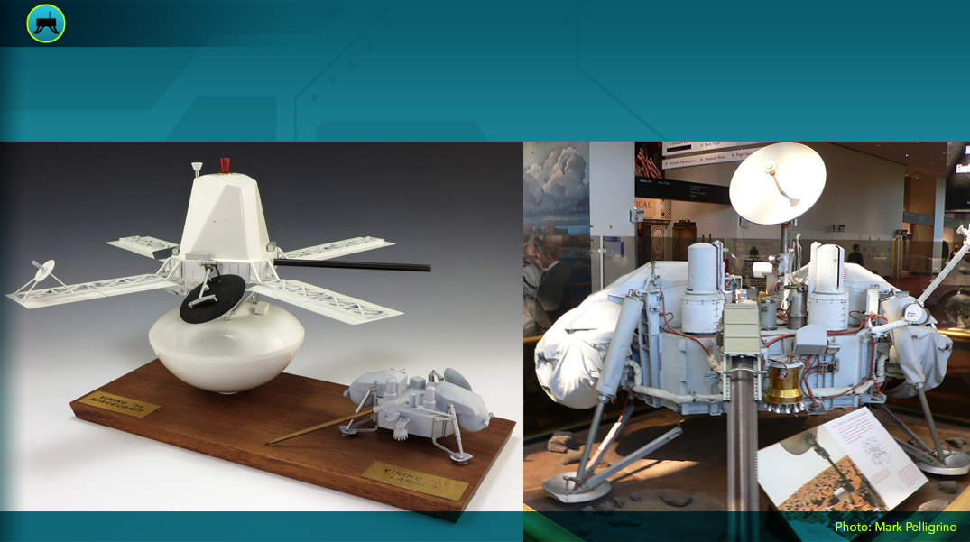
The navigation tools installed on InSightThe 4 large thrusters help InSight move in the right direction. The 4 small ones are used to stabilize the spaceship and keep it pointing in the right direction.
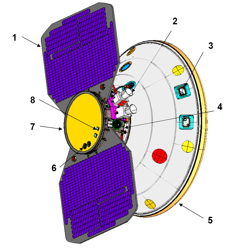
Configuration during transit to Mars: 1: Fixed solar panels (×2), 2: Star tracker (×2), 3: Thrusters (×4), 4: Medium gain antenna MGA, 5: Heat shield encapsulating the landing gear, 6: Solar sensor (×2), 7: Cruise stage, 8: Low gain antenna LGA ×2) (© NASA).
Maintaining InSight’s trajectory throughout the flight.A high degree of accuracy is required to allow the probe to touch down precisely at the scheduled landing site on Elysium Planitia, in the equatorial plains of Mars. The rocket provides the speed required to escape Earth’s gravitational field and head off towards Mars.
The path followed by the InSight probe is an arc of a circle, in orange on the NASA graphic below. One end of this arc touches Earth, while the other reaches Mars.
We can also see the orbit of Earth around the Sun on the blue trace. Its position at launch marked “Earth at Launch” and its position at landing marked “Earth at arrival”.
The orbit of Mars is the red trace. Its position at the time of launch is marked “Mars at Launch” and its position at the time of landing is marked “Mars at arrival”.
As seen in this graphic, InSight’s trajectory is not pointed directly at Mars, quite the contrary. The rules of planetary protection stipulate that in Martian exploration, everything must be done to avoid contaminating the red planet with terrestrial germs. As a result, Martian robotic devices are launched in such a way as to miss the target, to prevent the upper stage of the launcher, which follows the probes on their way, from crashing into Mars.
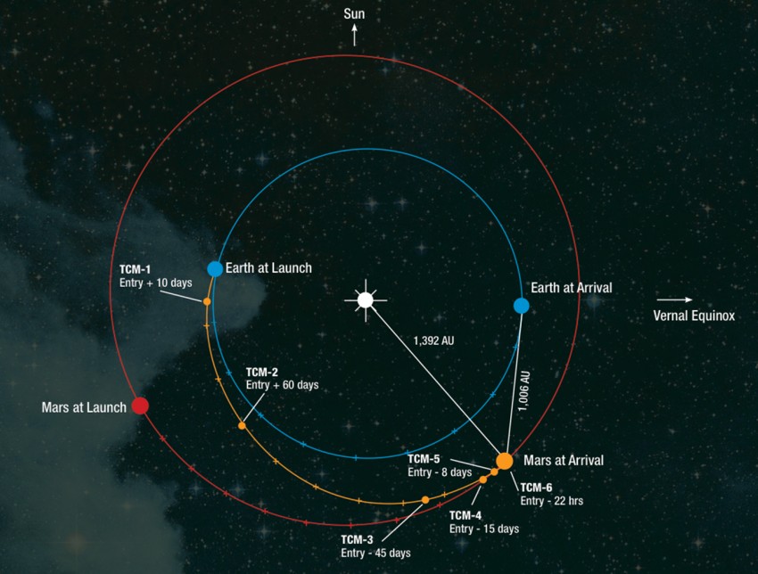
Trajectory followed by the InSight probe between Earth and Mars (© NASA).
Six adjustments to InSight’s trajectory were planned during this six and a half month journey
These adjustments are called “Trajectory Correction Manoeuvres”, or TCMs. They help refine the flight path so that InSight reaches the right point of entry at the top of the Martian atmosphere on the day of landing.
For the InSight mission, these 6 manoeuvres are numbered from TCM1 and TCM2. to TCM6, as you can see on the previous diagram.
All the other trajectory manoeuvres take place during the approach phase, which begins 60 days before the landing on Mars.
Their role is to fine-tune InSight’s trajectory, enabling it to enter the Martian atmosphere with the desired precision. The nose cone’s angle of attack on entry must be -12.5°. If the probe tries to enter the atmosphere at a lesser angle, it will bounce off and be lost in space, whereas if it approaches Mars at a steeper angle, frictional forces will cause the lander to burn up.
The InSight probe, just another satellite?This short film from the National Center for Space Studies (CNES) explains why satellites do not fall back on Earth when they go into orbit.
Orbiting satellites (© CNES).
Once the probe is in orbit around Earth, its engine will have to ignite for one last time, to set it on the right course for Mars. At such altitudes, Earth’s gravitational pull is much less strong, so only a small engine is required.
Great care is needed to ensure the accuracy of the calculations, as even a small error in the ignition time or trajectory could leave the probe so far away from Mars that the mission would fail!
However, all these details will be checked and re-checked 100 times before liftoff, so this kind of mission has more than a 99% chance of success.
Quiz!
Validate your knowledge!
Communication InSight-Earth
 How does InSight communicate with the Earth during its journey?
On board the rocket that carries InSight into space are also 2 nanosatellites, MarCO-A and MarCO-B, each weighing about 13.5 kg being about the size of a small suitcase 36.6 cm long, 24.3 cm wide and 11.8 cm high.
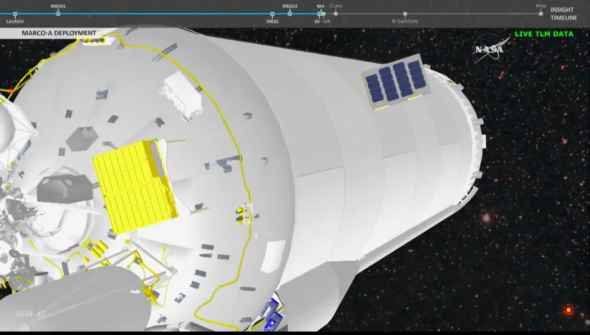
MarCO-A has separated from the rocket while MarCO-B (in the yellow box) is still attached to it. (© NASA-JPL Caltech).
MarCO-A and MarCO-B are attached to the base of the Centaur stage (opposite the payload fairing). After switching off the rockets and once the InSight probe is released, the Centaur stage rotates 180° and releases MarCO-A. After a second rotation MarCO-B is released.
Then, MarCO-A and MArCO-B each unfurl 2 solar panels (30 x 30 cm), 1 high gain antenna and a UHF antenna in anticipation of a 6 1⁄2 month cruise to Mars.
MarCO-A has two solar panels, a cold gas propulsion system for trajectory corrections and orientation changes in space, and solar sensors to locate oneself in space. The same applies to MarCO B. (© NASA-JPL Caltech).
MarCO A and MArCO B are therefore autonomous and can follow InSight until it lands on Mars.
MarCO-A and MArCO-B follow InSight until its landing on Mars (© Arteclick).
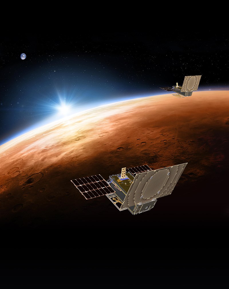
The role of MarCO-A and MArCO-B is to transmit in real time the measurements sent by InSight to Earth, during its flight, entry into the atmosphere, descent and landing on Mars.
The 2 nanosatellites, MarCO-A and MArCO-B, are the radio relays transmitting data to Earth during the flight and especially during the landing of InSight (© NASA).
How does InSight communicate with the Earth during landing?Unlike other space probes, InSight does not have the ability to transmit information directly to Earth during its descent to Mars.
Designed as “radio relays”, MarCO-A and MarCO-B operate as both data receivers and transmitters. So throughout the critical landing phase, MarCO-A and MarCO-B will transmit in real time the progress of operations until InSight is in position on the surface of Mars.
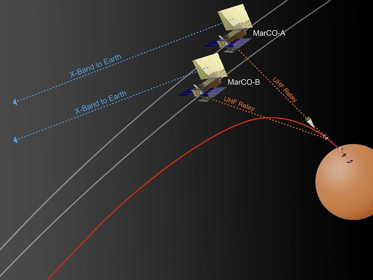
InSight communication during its descent and landing on Mars. MarCo A and B are in relay near Mars (© NASA).
First, the CubeSats receive data from InSight (signal labelled UHF Relay in the picture above) and then MarCO-A and MarCO-B transmit this data to NASA’s terrestrial deep space listening network (DSN) antennas.
Once InSight is on the Martian surface, MarCO-A and MarCO-B, having finished their mission, will pass Mars and get lost in interplanetary space.
How does InSight communicate with Earth from the surface of Mars?Thanks to the DSN network, any satellite in the the solar system is able to communicate with at least one DSN station. These stations also communicate with satellites to make course corrections, provide software updates, and change the way scientific observations are made.
The DSN is composed of 3 antenna stations on the ground. They are the Goldstone Complex in California located approximately 120° from the Madrid Complex in Spain which in turn is located approximately 120° from the Canberra Complex in Australia.
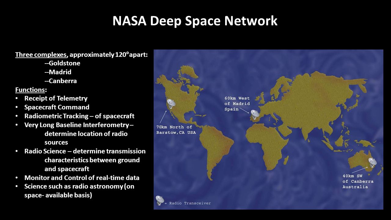
Map of NASA's DSN global network. There are 3 sites, California USA, Madrid Spain, Canberra Australia (© NASA).
Each of the stations in the DSN network is composed of several antennas 70 meters in diameter.
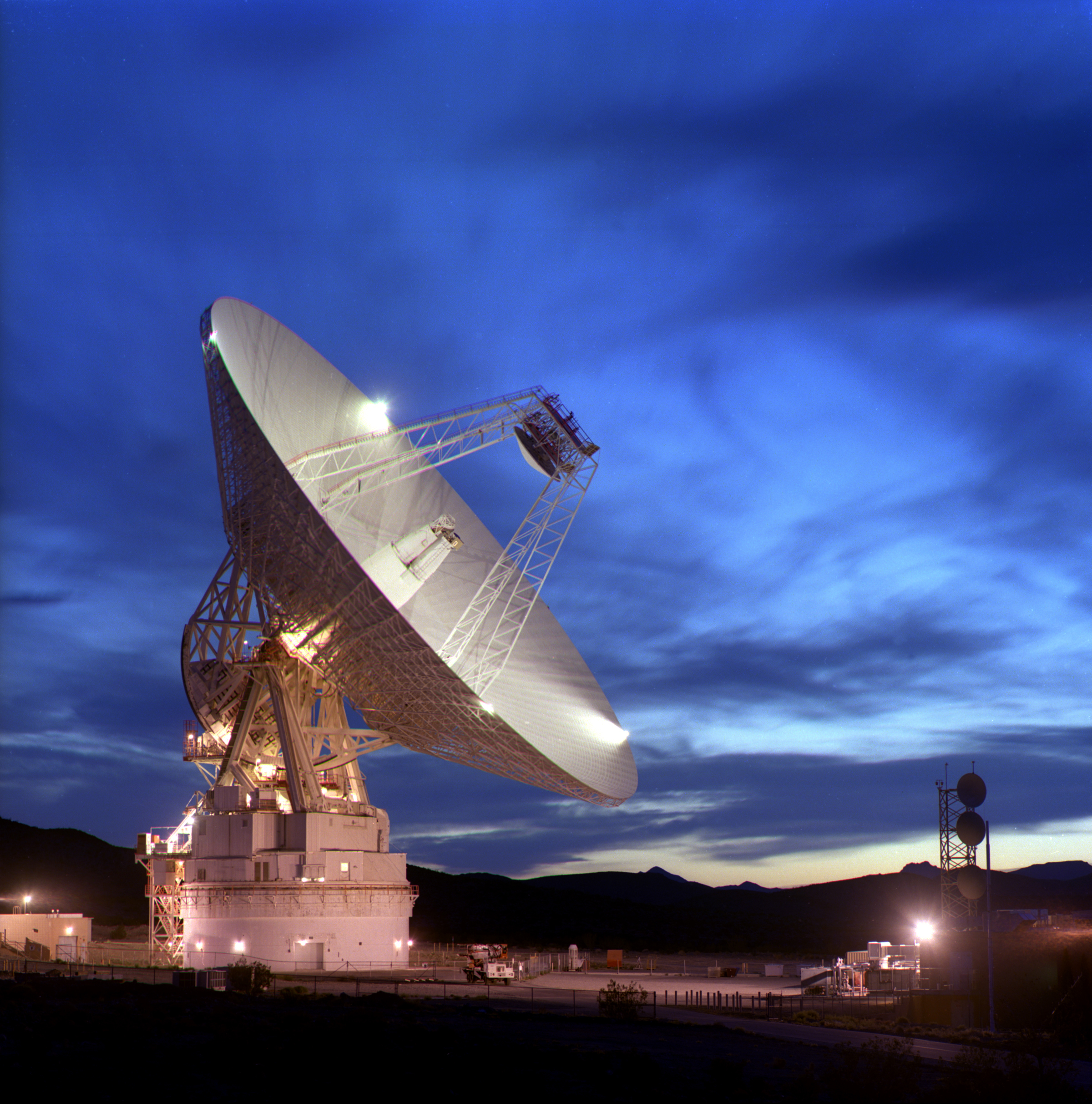
Example of a 70-meters diameter antenna at the Goldstone Complex in California (© NASA).
When Mars and Earth are closest, i.e. 56 million kilometres away or 0.37 AU, then it takes 3 minutes and 7 seconds for a signal from a DSN station to reach Mars (1 AU = 149.56 million kilometres).
When Earth and Mars are at the furthest from each other at about 381 million kilometres (or 2.52 AU) then it takes 20 minutes and 57 seconds to transmit the same radio signal.
InSight communicates directly with the DSN on Earth every day. But most of the time InSight will use the closest orbital probes around Mars as communication relays, such as Mars Odyssey, Mars Global Surveyor or Mars Reconnaissance Orbiter. From October 2018 the European TGO orbiter will arrive at Mars and serve as another relay for data transfer.
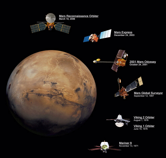
Communication satellites around Mars (© NASA).
What happens when the sun blocks our signal? (© NASA/JPL).
Quiz!
Validate your knowledge!
Landing of InSight on Mars

Choosing InSight’s landing site is a difficult decision with many technical and scientific constraints.
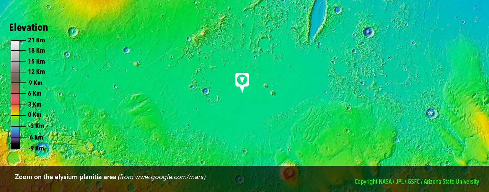
Insight’s landing site is the plain of Elysium. This place was chosen by the members of the expedition because it possesses 5 important qualities.
Quality No. 1 : An equatorial location
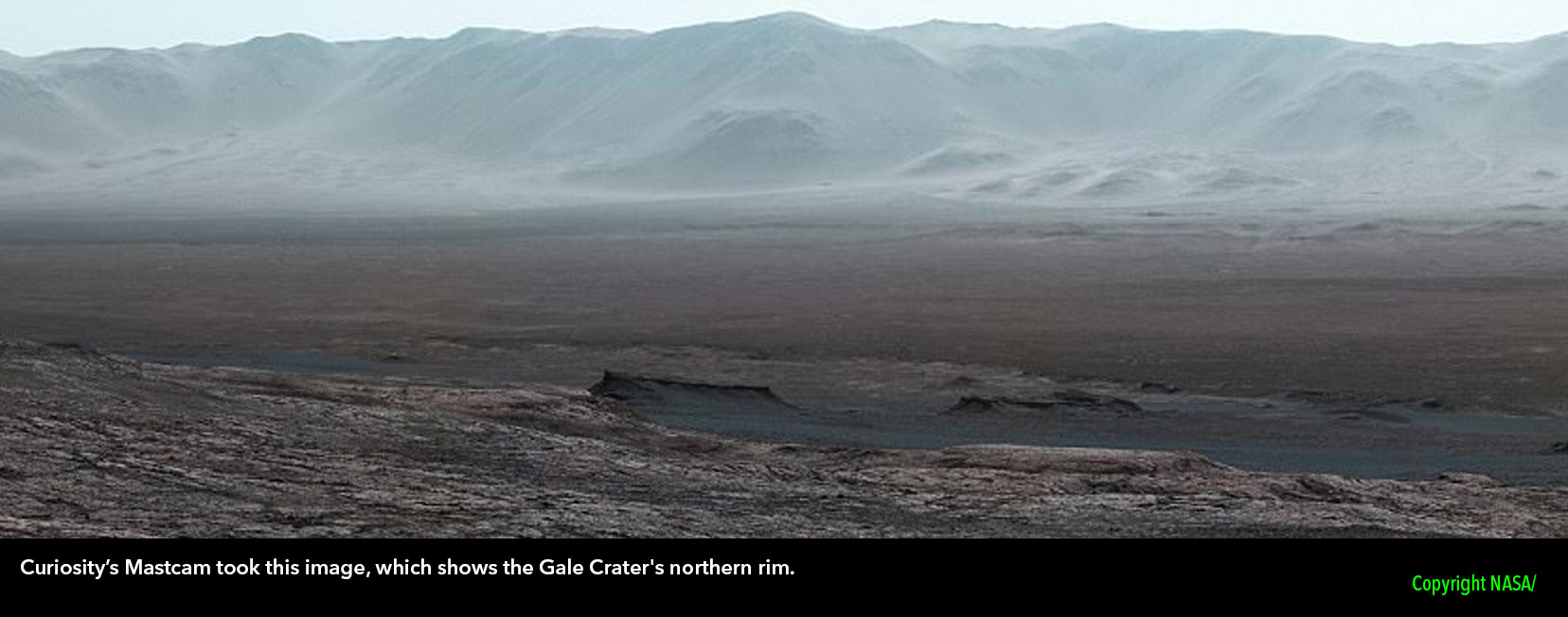
The InSight landing site is in the Elysium Plain (also called Elysium Planitia), in an ellipse 130 kilometres long and 27 kilometres wide. This region is located near the equator, at a latitude of 4 ° North.
Elysium Planitia experiences maximum sunshine every day of the year. The solar panels of the lander are able to operate and supply electricity to the on-board equipment and scientific instruments for the duration of the mission. This maximum sunshine, 687⁄687 days, also reduces the risk of damage to the electronic components and mechanisms of the probe during the cold Martian nights: -120 ° C!
Choice of InSight Landing Site (© Arteclick).
Quality No. 2 : A low altitude
InSight has to slow down during its descent and for this the atmosphere of Mars plays an important role. To get the thickest possible layer of atmosphere, the engineers selected a plain, rather than the top of a volcano. Located 2.6 km below the average altitude of Mars, the Elysium plain has a thick layer of gas above it which ensures long and effective atmospheric braking (even though the density gas is very low, only 1% of Earth’s atmosphere).
The choice of InSight's landing site has been difficult, with many technical and scientific constraints (© NASA-JPL Caltech).
Quality No. 3 : A smooth and unobstructed surface
The engineering challenge is to make a stable and horizontal deploymenet of SEIS and HP3
The success of landing InSight depends on the topography of the landing field. The probe must be able to land, with confidence, on its 3 feet. Steep slopes, soils strewn with large pebbles, lands marked by crevasses or impact craters should be avoided at all costs so as not to risk the lander ending up in an unstable position. The petal-shaped solar panels must also open without encountering obstacles and to ensure their optimal performance should not be subject to shading from nearby rocks. The French seismometer SEIS, the main instrument of the mission, must be in COMPLETE contact with the surface of the red planet. A camera located on the elbow of the robotic arm of the lander will allow engineers to choose precisely its location: with no chance of placing it on a pebble! Of all the candidate sites, the Elysium Plain is the one with the largest proportion of its area classified as smooth.
By scrolling the photos in the window below, you can see the different types of landscapes on Mars. There are a lot of big pebbles, hollows, bumps …. not easy for InSight to find the right spot !


Quality No. 4 : Low winds
There is a weather station on the lander. It measures wind and pressure variations and subtracts these signals from those detected by the seismometer, to ensure that only seismic signals remain, not wind squalls.
Quality No. 5 : Soft ground
In addition to the French seismometer, InSight’s robotic arm must also deploy the HP3 temperature probe. In order to overcome variations in surface temperatures, HP3 must burrow up to 5 m deep. To do this the ground at the landing site must be soft. The basement of the Elysium plain is formed by a layer of regolith (friable and crushed material) sufficiently thick and weak to allow the penetrator of the HP3 instrument to burrow without much difficulty.
Did you know that Elysium is a Latin term that refers to the Elysian fields, a plain of light, from Greek mythology where humans were judged after their death, and where virtuous souls could settle and finally find rest.
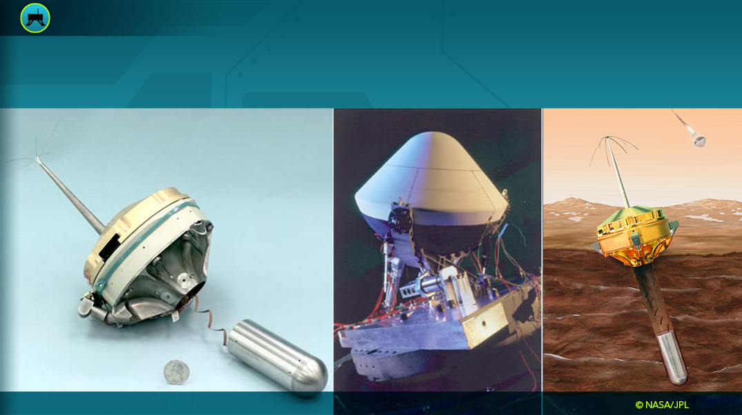
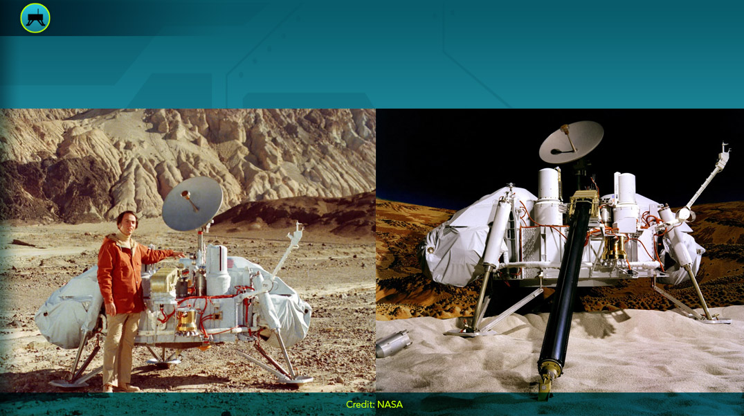
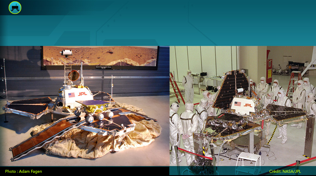
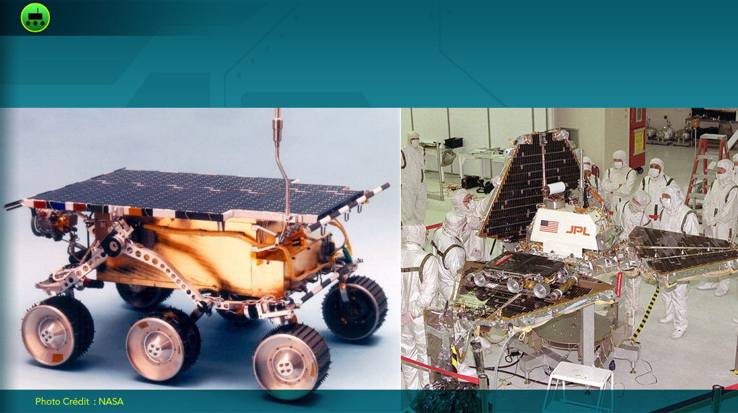
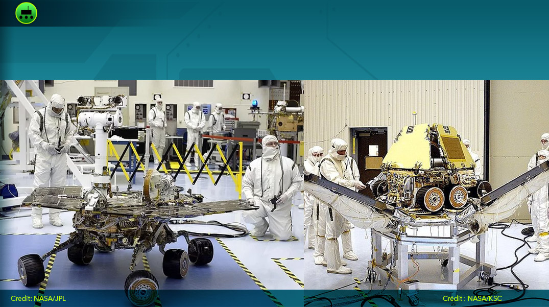
To discover the missions that have landed on Mars, successfully or unsuccessfully, use this interactive map !
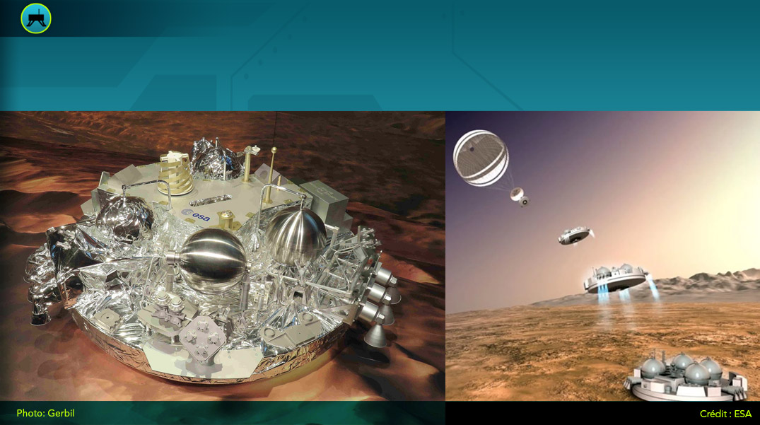
The orbiter transmitted data for several months. However, the lander malfunctioned 20 seconds after deploying its instruments. 1 single dark and blurry photo of the Martian soil was transmitted.
Nevertheless, Mars 3 is the first human machine to land on Mars successfully.
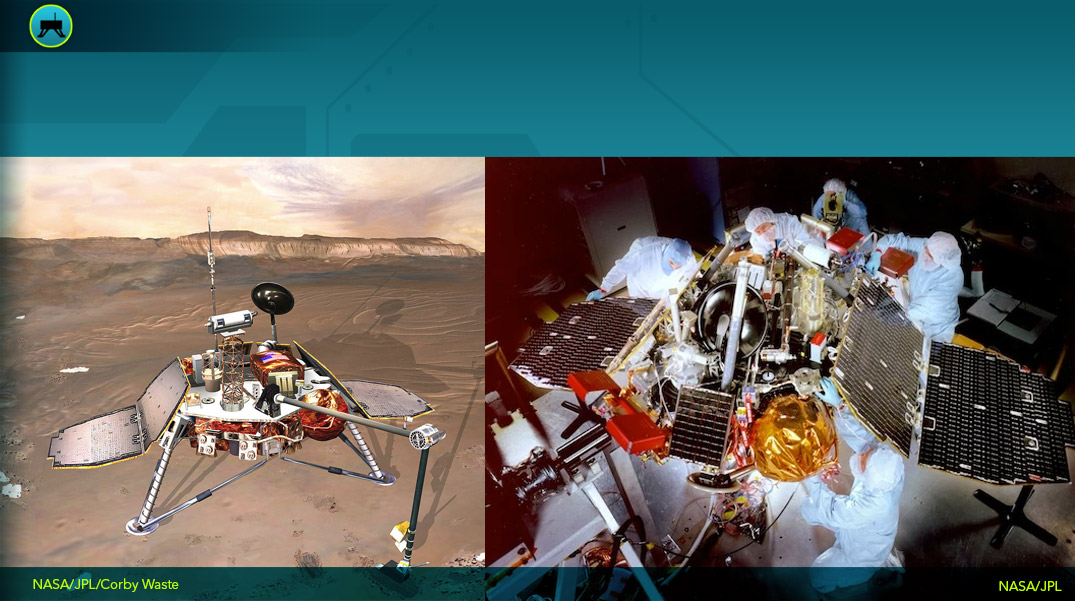
Both identical landers contained more than 90kg of scientific equipment including cameras and a weather station. Despite having all these instruments and the large amount of data collected by the landers, they found no definitive evidence of life on Mars.
Viking 2’s mission ended because of a battery problem.
In addition to studying the rocks of Mars, Curiosity successfully tested a new landing technique. For large heavy rovers such as Curiosity, a rocket-powered descent stage has been developed.
The system hovers above the ground and brings the rover down with cables. Then it detaches and goes to crash further away.
The Earth lost contact with the lander and probes just before they enter the atmosphere. Attempts to communicate were unsuccessful.
The lander and probes are still missing from the pictures of the surface of Mars.
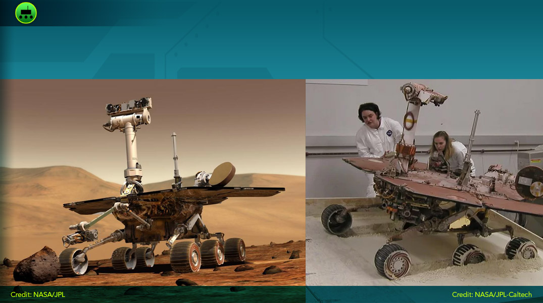
Spirit and Opportunity weigh 185 kg each and move on 6 wheels. Spirit traveled 7.7km, but got trapped in a sand dune in 2009. Stuck in a place without sunlight, it could not recharge and stopped communicating with the Earth in March 2010.
Spirit was supposed to operate for 90 days, but managed to last more than 5 years.
The Earth lost contact with Mars polar Lander and probes just before they enter the atmosphere. Attempts to communicate were unsuccessful.
Mars polar Lander and probes are still missing from the pictures of the surface of Mars.
During winter, Phoenix goes into power-saving mode because there is not enough sun to recharge its batteries. Unfortunately, in the summer of 2008, efforts to restart it failed.
As a result of this mission, the presence of frozen water in the Martian ground is confirmed.
Both identical landers contained more than 90kg of scientific equipment including cameras and a weather station. Even with all these instruments and the large amount of data collected by the landers, they found no definitive evidence of life on Mars.
Viking 1’s mission ended because of an error with its software update that cut off communication with Earth.
On Mars, Pathfinder takes pictures and does scientific analysis. It also acts as a communication relay between Sojourner and Earth.
Between the pair of them, Sojourner and Pathfinder sent back to Earth 17050 images. Thanks to them, traces left by liquid water were found.
As the first rover on Mars, Sojourner conducted experiments on wheel wear and material resistance. Cameras and a laser system helped it to avoid obstacles.
Thanks to Sojourner and Pathfinder’s analyses, traces left by liquid water were found.
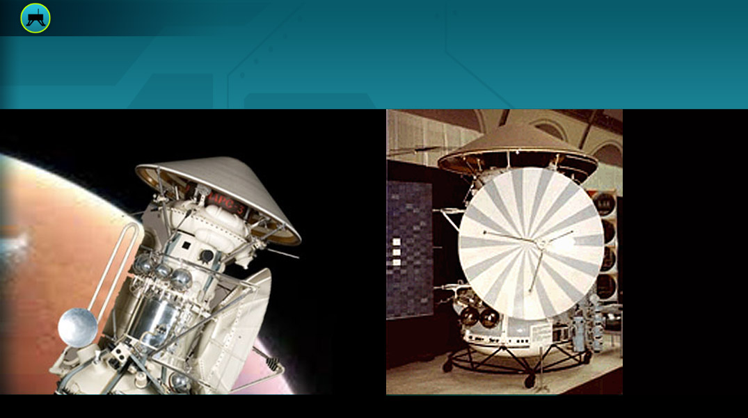
Before crashing, Mars 6 managed to transmit some informations about its descent.
Spirit and Opportunity weigh 185 kg each and move on 6 wheels. To date, the rover Opportunity has travelled 45km and analyzed 5,000 soil samples, in June 2018 it was caught in a sandstorm that blocked the sun’s rays.
Opportunity switched to power-saving mode. Since then, attempts to contact it again have been unsuccessful. On February 13, 2019, NASA announced the official end of the mission, a record for longevity because its 3-month mission lasted 14 years!
After entering the atmosphere, the lander sensors create an error in the navigation system and trigger the parachute to open and detach too early. Schiaparelli then makes a free fall of more than 3km and crashes to the ground.
Despite this failure, the discovery of defects in the navigation system helped to improve it for future missions.
At the moment of entry in the atmosphere of Mars, the landing gear’s angle of entry was not good and it crashed to the ground.
Its orbiter was intact and transmitted information about the planet Mars for several months.
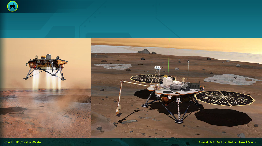
The lander arrives on Mars on December 19, 2003, but did not communicate with Earth. It was first thought to have crashed to the ground, but it was found again 2 years later thanks to the pictures taken by an orbiter.
On the pictures, we can see that it is half deployed. After a successful landing, this step is important to receive solar energy and be able to communicate. A problem during this step makes the lander inoperable.
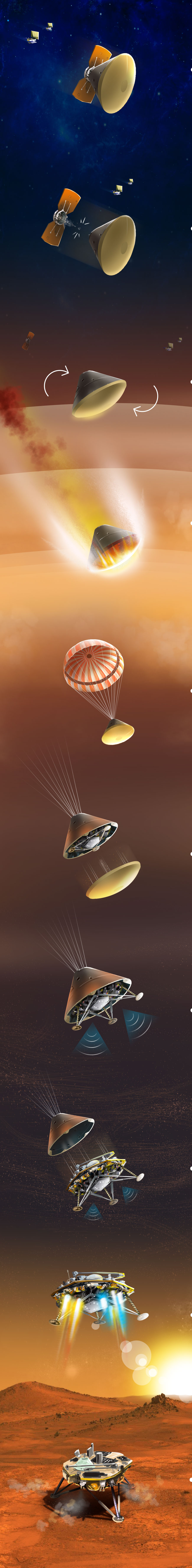
 The landing phase, the most critical stage of the mission
This is the most difficult phase of the mission to control. It begins exactly 3 hours before contact with the highest layers of the Martian atmosphere, about 125 kilometres above the surface.
Objectif Mars: In the heart of Mars (© CNES, Team SEIS)
Below, discover the different stages of this great adventure !
November 26, 2018, InSight lands on Mars !
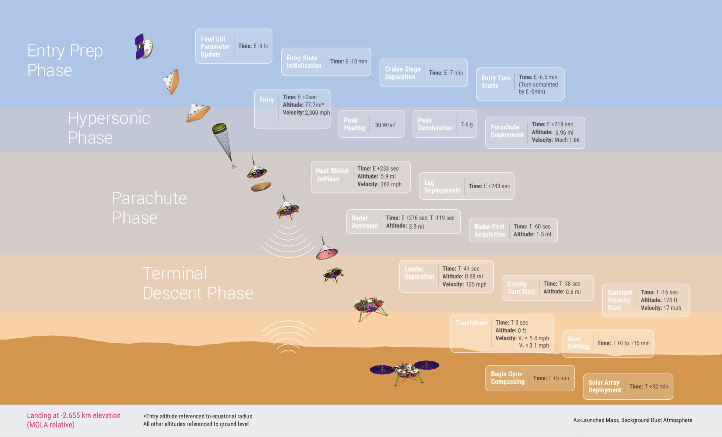
Landing: The most critical phase of the mission. (© NASA- JPL Caltech).
Look below and see InSight's re-entry and landing


 Trace the landing of InSight on the Martian surface
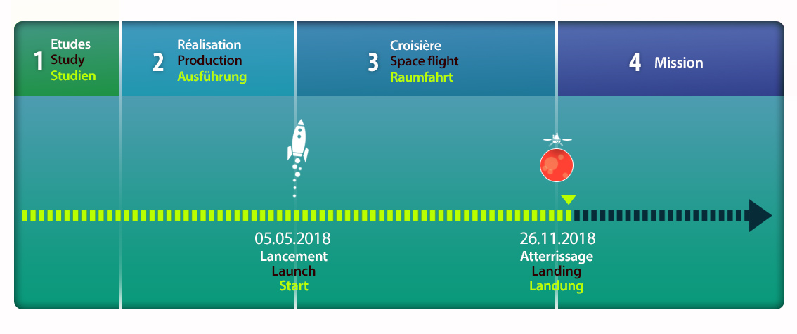
Timeline of the Insight mission (© Arteclick).
The choice of the InSight landing site was difficult with many technical and scientific constraints. This animation shows the difficulties.
The choice of the InSight landing site was difficult with many technical and scientific constraints (© NASA- JPL Caltech).
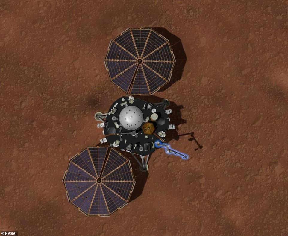
Landing successful ! Insight successfully landed on the Elysium Plain of Mars
Landing of InSight on Mars (© NASA- JPL Caltech).
Congratulations to the whole team !
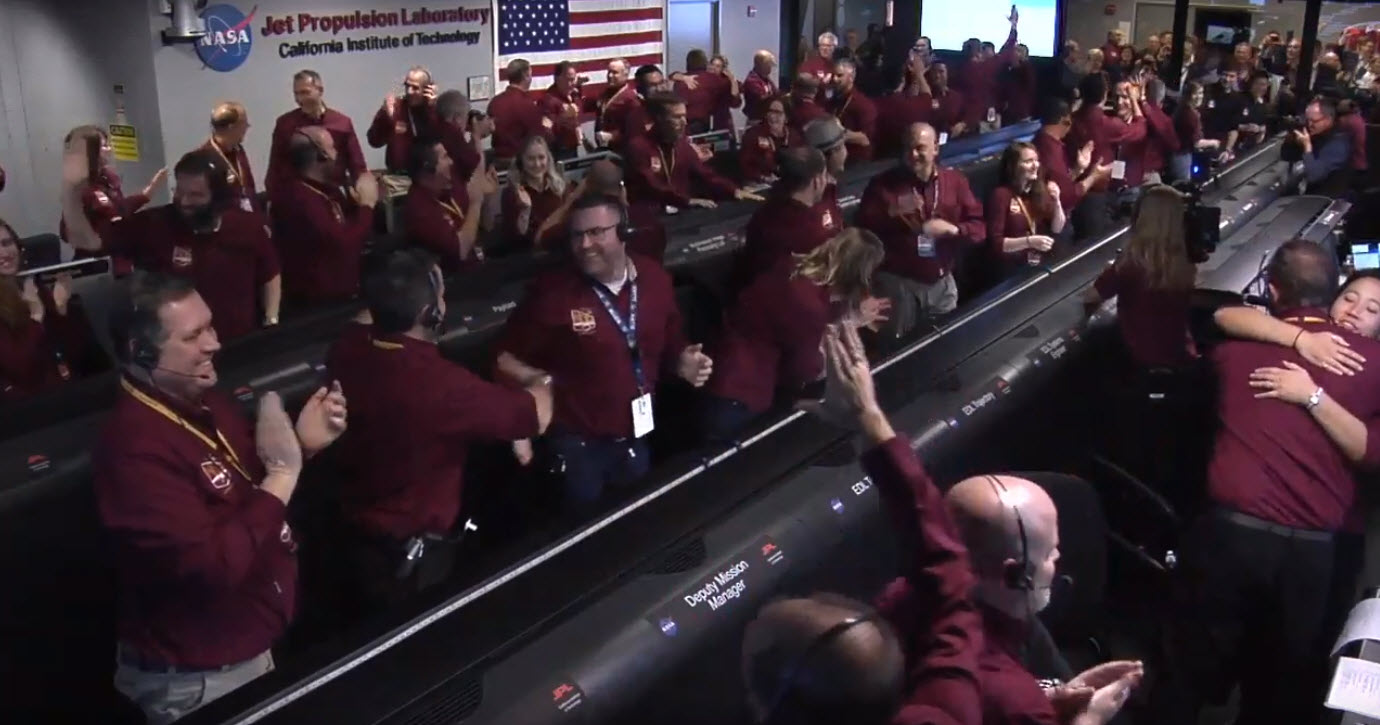
The project team celebrate the successful landing of InSight at mission control in Pasadena, California (© NASA/JPL-Caltech).
Below, photos taken by the Mars Reconnaissance Orbiter space probe. They show the different parts of the landing gear: the heat shield, InSight and the parachute. The dark circle around the probe is caused by the dust raised during the landing.
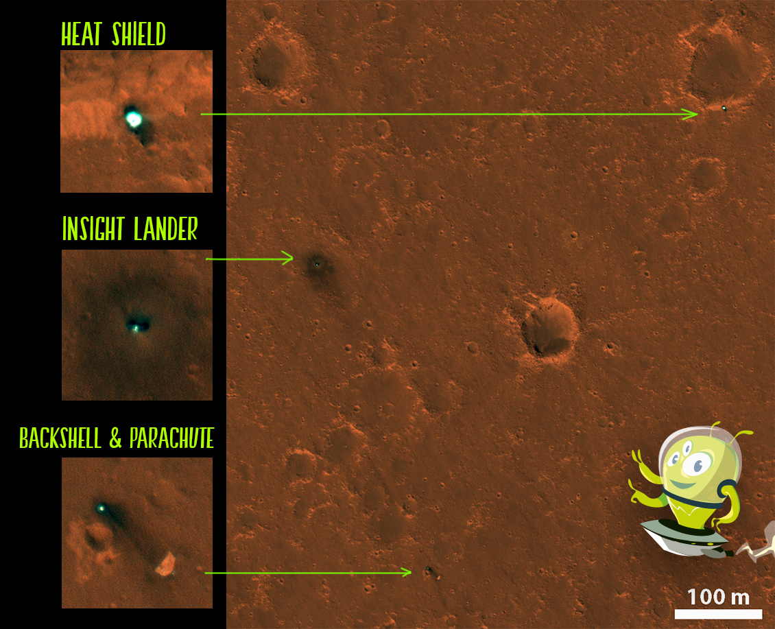
InSight on Elysium planitia (© NASA/JPL/University of Arizona).
Quiz!
Validate your knowledge!
Installation of InSight on the surface of Mars
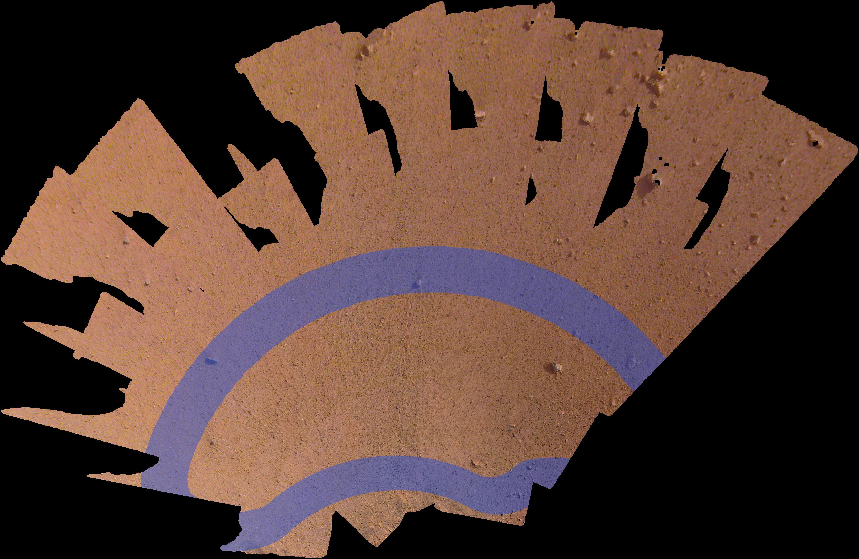
Choice of the deposit area for instrumentsBefore the instruments are deployed, the Insight Mission team must select the installation area from photographs taken by InSight cameras. Since the robot arm of InSight limits the movements to an area of 3 metres long and 2 metres wide, the choice of area is very important. The camera moves to acquire stereo images, which overlap about 80% and provide full ground coverage. These images are recorded, and used to produce a digital model that recreates the real terrain with centimetre resolution.
Engineers select the drop zone (© NASA/JPL-Caltech)
Before each move, the InSight mission team trains on its ForeSight twin in the Jet Propulsion Laboratory (JPL) in California. Researchers recreate the probe environment with the first photos sent by InSight.
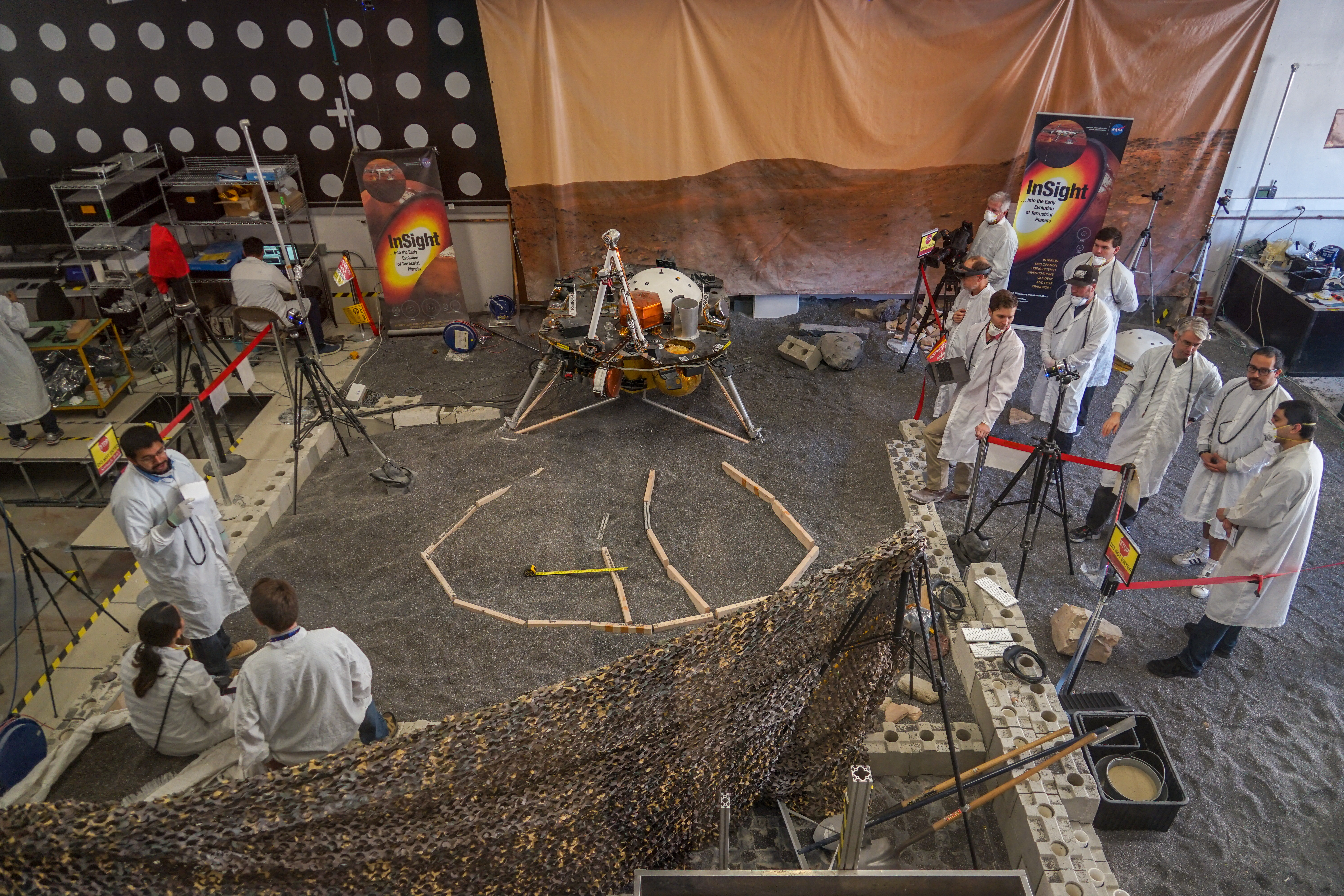
Engineers reproduce the Martian surface (© NASA/JPL-Caltech/IPGP)
In order to prepare for the deployment of the seismometer and the heat probe everything is reproduced here, from the pebbles on the ground to the ambient light. Engineers perform their tests and develop a set of computer commands that will be sent to InSight.
Laboratory tests of the InSight probe (© NASA/JPL)
Once validated, commands are sent to Mars, instructing the InSight probe to execute them. Step by step, this process is repeated, until the instruments are properly deployed on the ground.
Scroll through the images to see how InSight got started on Mars:
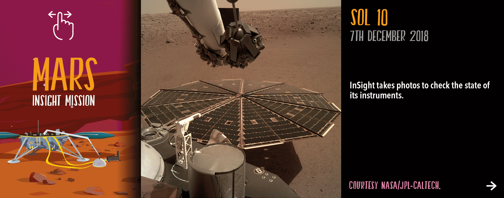
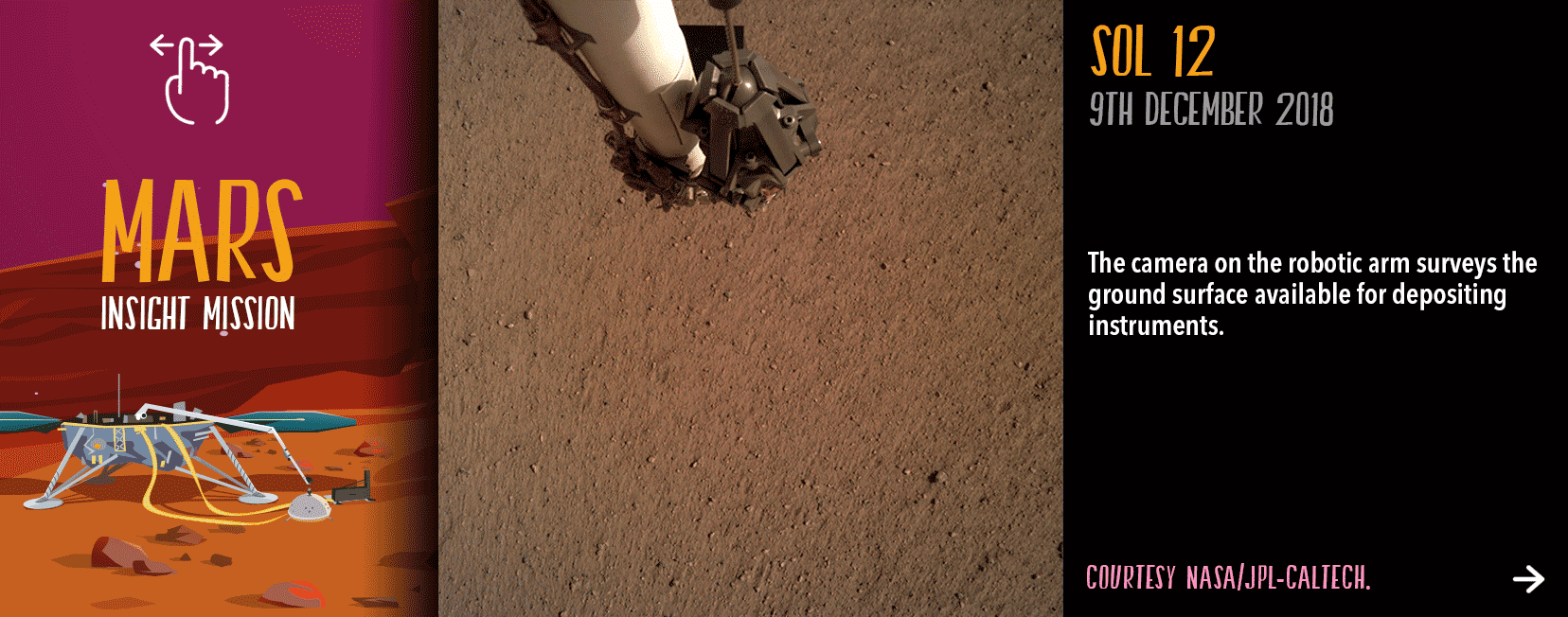
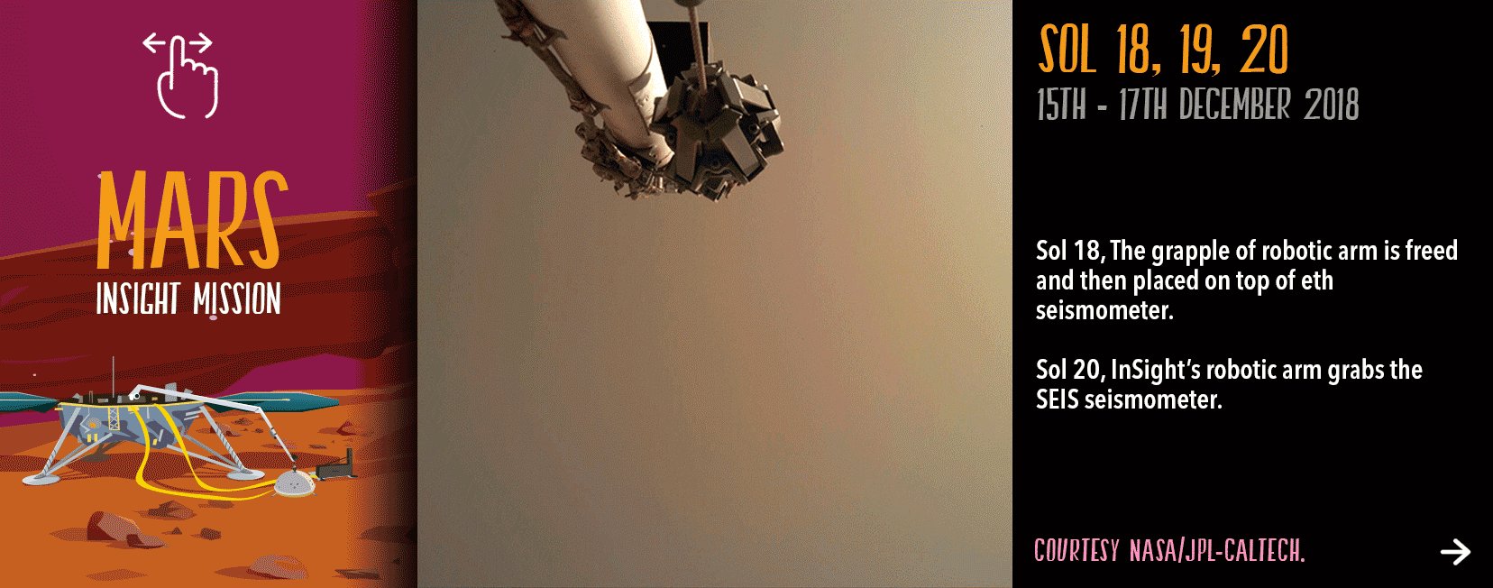 InSight deploys to Mars
The deployment of InSight (© Arteclick)
On November 26, 2018, once the InSight probe is safely on the monotonous and dusty Elysium plains, it will have to tackle an essential part of its mission: placing its two main instruments, the SEIS seismometer and the HP3 heat flow sensor securely on the ground.
The deployment of InSight on Mars is a delicate task that lasts several weeks. (© Arteclick)
The deployment of InSight on Mars is a delicate task that lasts several weeks.
This critical phase of deployment operations is divided into six parts and lasts up to two months after landing. During this period, the teams are on permanent duty, in contrast during the scientific measurment phase the probe operates autonomously.
Below, the provisional schedule of operations (Sol = 1 day on Mars)
Sols 0 - 5: Initialization of the landing gear and preparation for the deployment of the instruments.
Sols 6 - 18: Characterization of the space available for the positioning of the instruments by the cameras and selection of the most interesting potential sites.
Sols 7 - 18: Beginning of RISE data acquisition (geodesy).
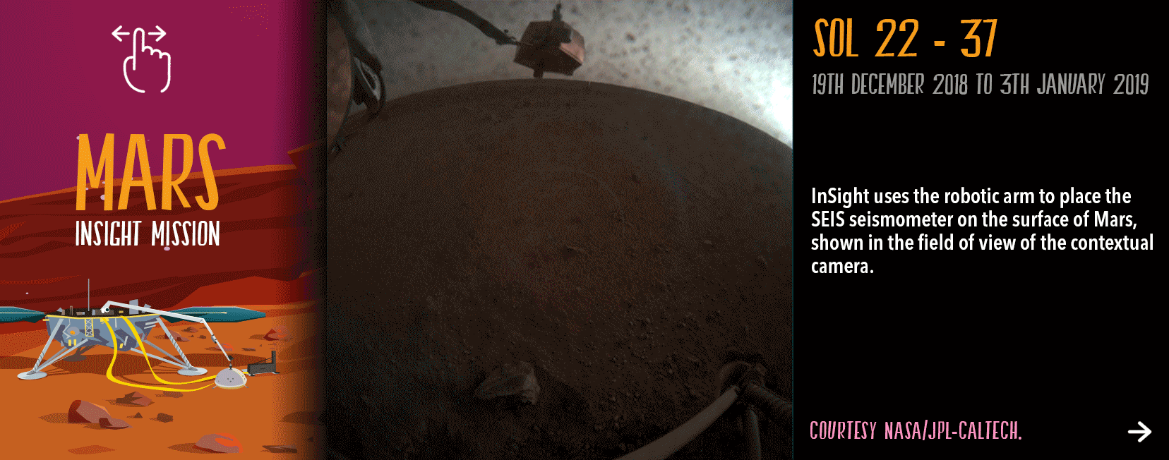
Sols 19 - 31: Deployment of SEIS seismometer (see details below). Start of measurements in engineering mode.
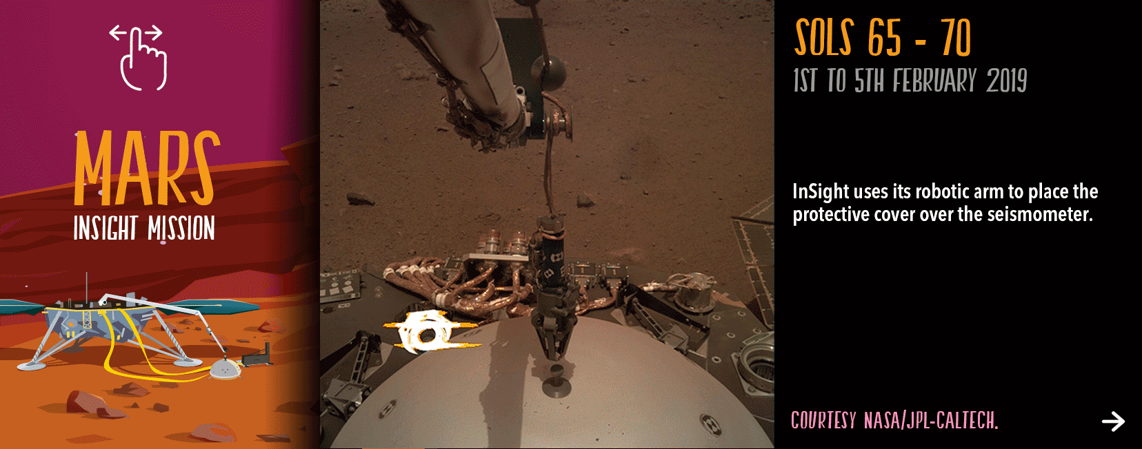
Sols 32 - 43: Deployment of the thermal and wind shield WTS on the seismometer. Beginning of SEIS scientific measurements from the ground 40.
Sols 44 - 58: Deployment of the HP3 heat flow sensor. No longer needed, the robotic arm is parked in its rest position on the lander deck.
Sols 59 - 69: Start drilling operations with the HP3 indenter.
Deployment of InSightThe InSight probe draws all the energy it needs from solar panels.
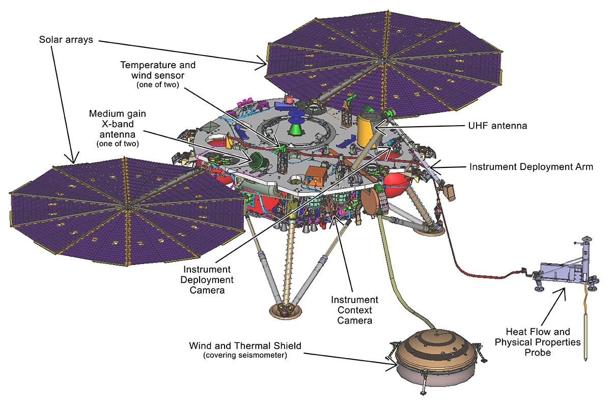
The different instruments on InSight. (© IPGP/SODERN/CNES).
The limitations of the robotic arm movement mean that SEIS and HP3 are placed near the base of InSight, in an area 3m long and 2m wide.
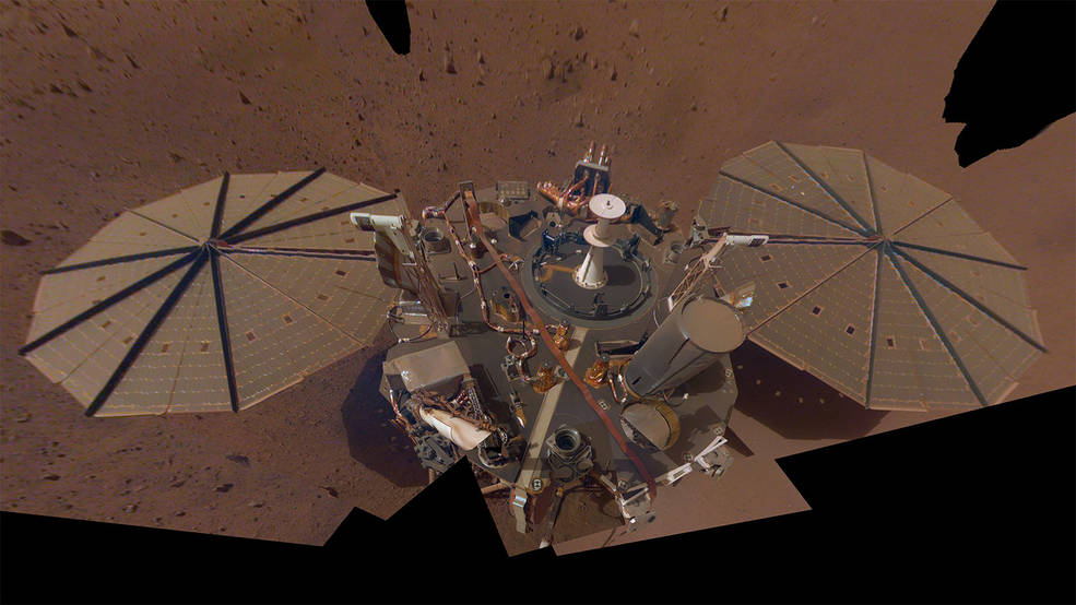
InSight's second full selfie on Mars. The lander has removed its heat probe and seismometer from its deck, placing them on the Martian surface; a thin coating of dust now covers the spacecraft as well (© NASA/JPL-Caltech).
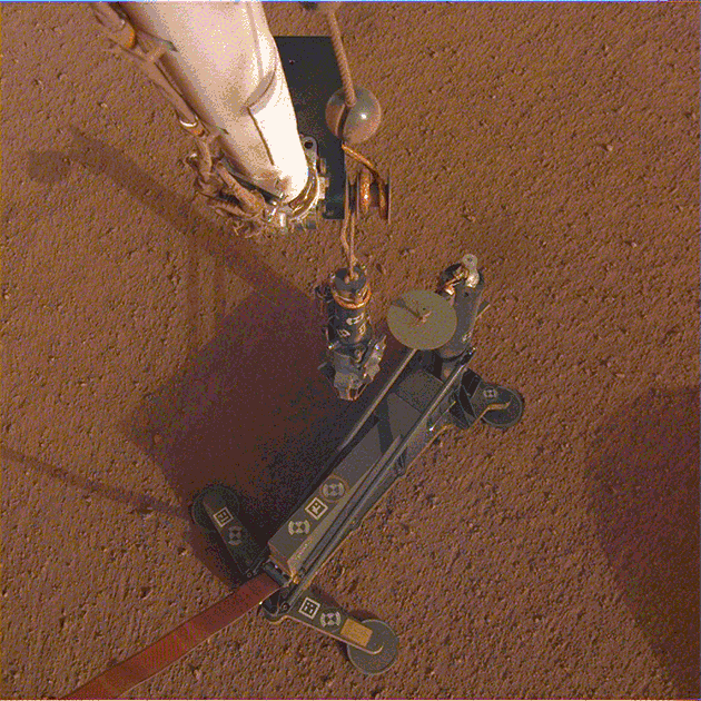
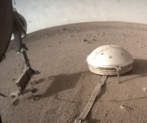
Deployment of SEISOn December 19, 2018, the SEIS seismometer is deplotyed first on Martian soil.
Its mission is to listen to the vibrations of the ground on Mars in order to detect any sign of an earthquake showing internal geological activity. And for that, SEIS is an incredibly accurate tool. It is able to detect jolts of the surface with an accuracy of 0.00000000000250 meters!
SEIS is placed on a flat surface with an inclination of less than 15°. The latter must also be able to support the weight of the seismometer and its thermal protection shield. Finally, the seismic coupling, i.e. the quality of the contact between the ground and the seismometer feet, must be excellent.
(for more information on the implementation : https://www.seis-insight.eu/en/)
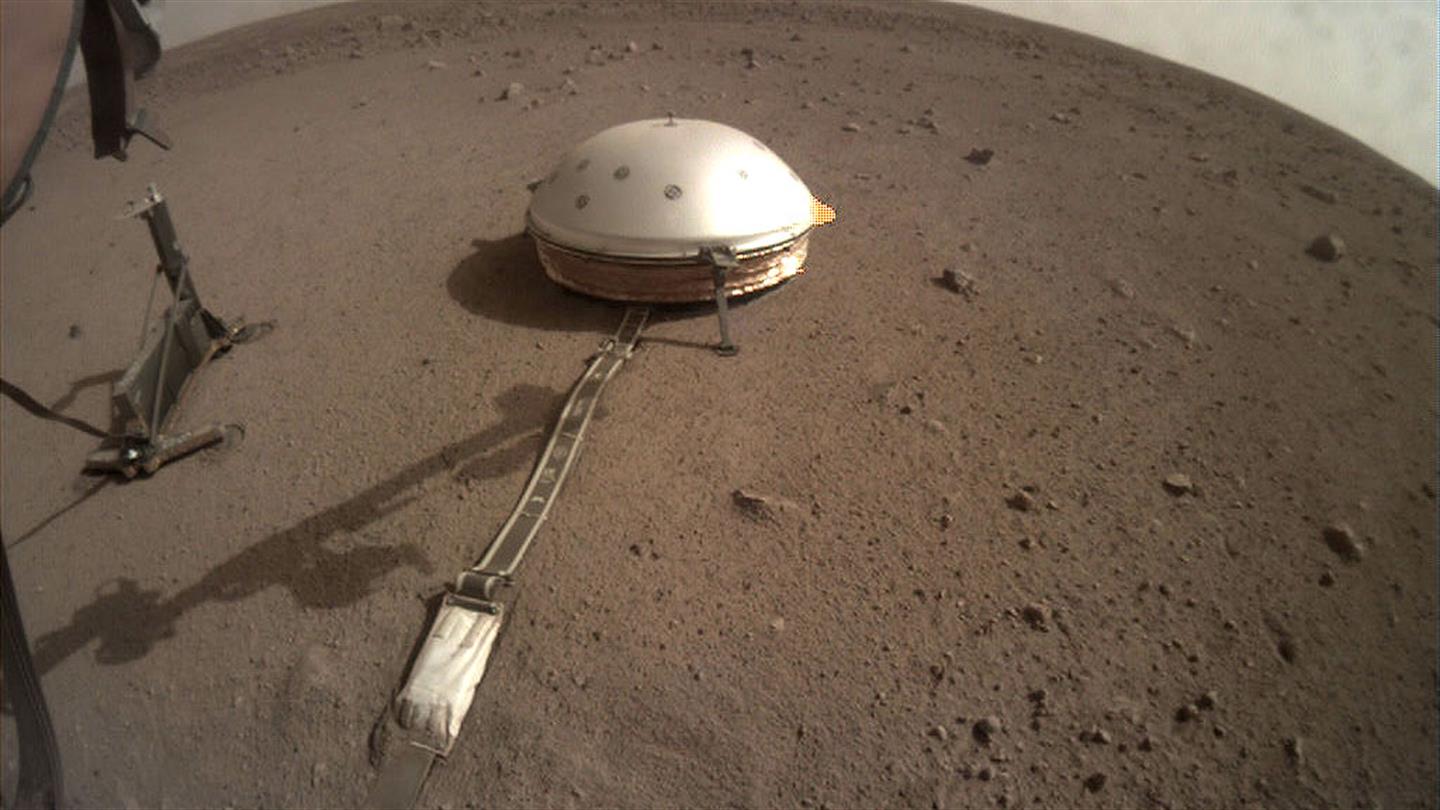
Installation of SEIS on Mars (© NASA).
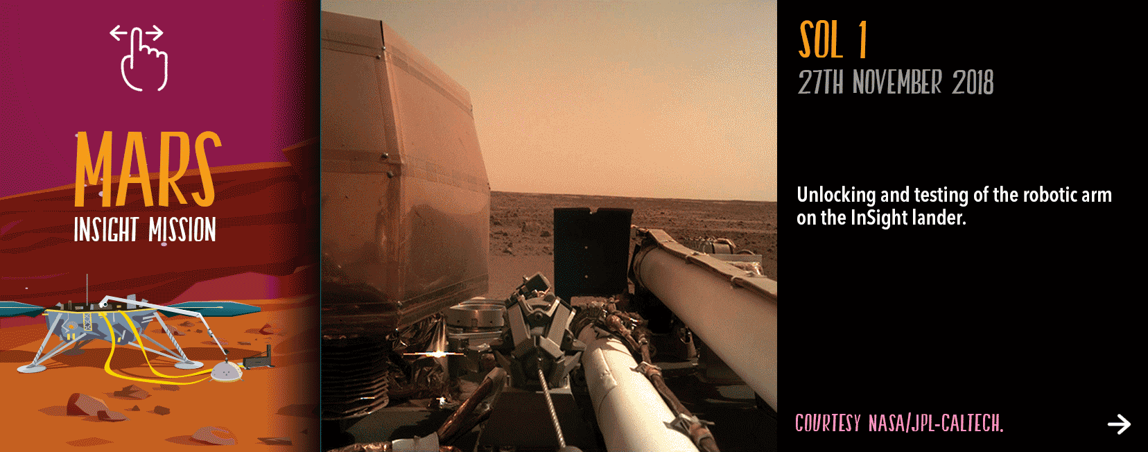
Here is the first photo taken by the InSight probe from the surface of Mars !
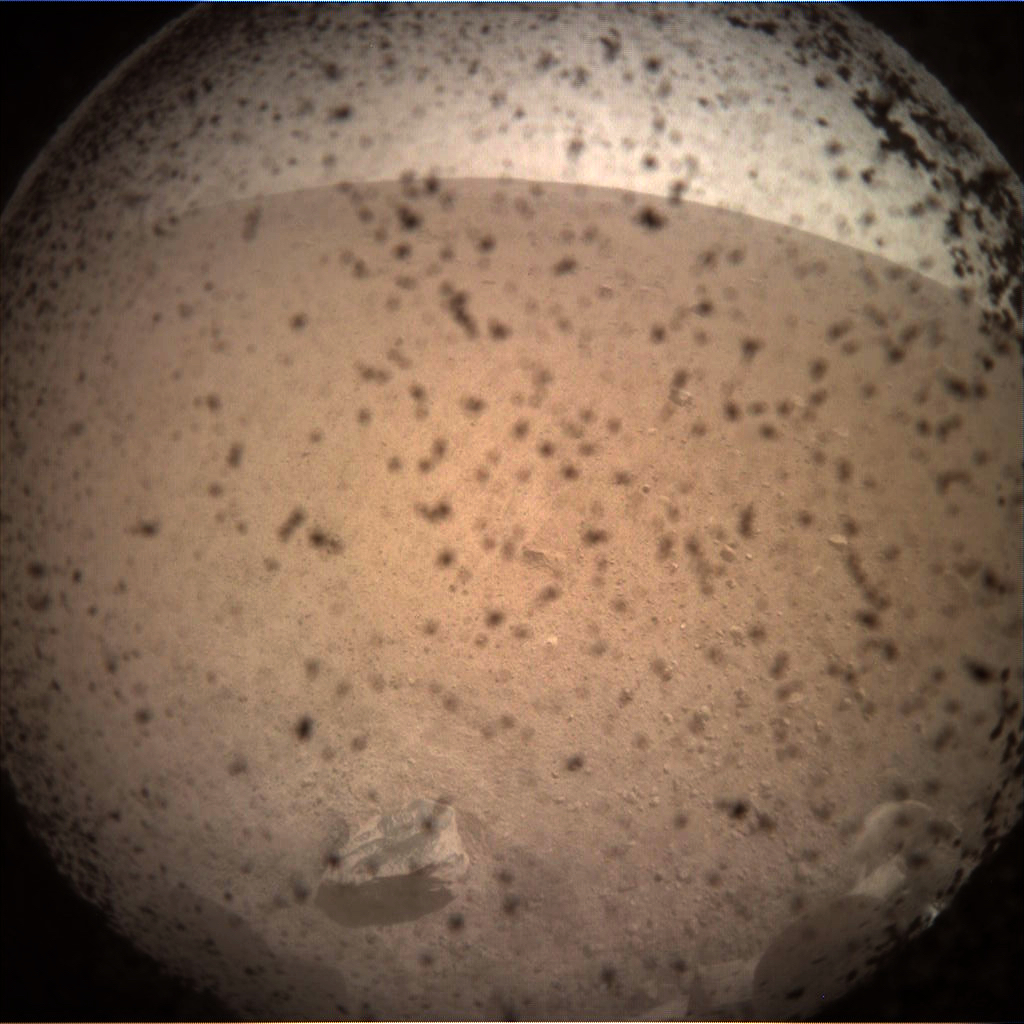
First photo from InSight on the Martian surface.Here is the first photo taken by the InSight probe from the surface of Mars. At this time, the camera is still covered with its transparent cap that protects it from the dust raised during the landing. (© NASA/JPL-Caltech).
SEIS is now in position, protected from winds and thermal variations by a shield. All implementation tests have been carried out. A little over 2 months after landing, the first seismic measurements can then really begin to reveal the internal structure of Mars.
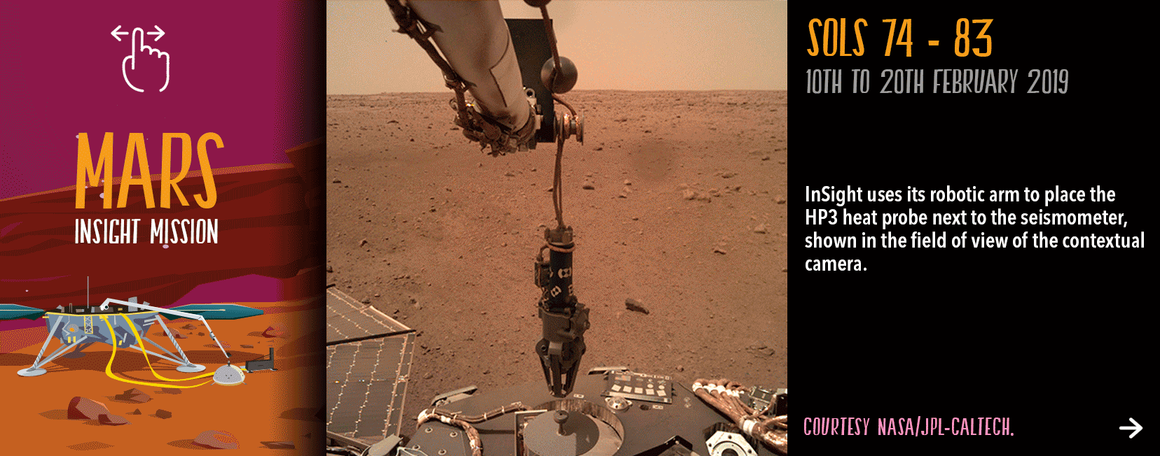
Deployment of HP3On February 12, 2019, the HP3 probe was placed on Martian soil about 1.5 meters from InSight.
Its mission is to measure the temperature and thermal conductivity of the subsoil and thus determine the heat flux of the interior of Mars. HP3 is a superthermometer. With this information, planetologists will be able to estimate the temperature of the mantle and deduce whether or not there is a hot liquid core inside Mars.
To take its measurements, HP3 is equipped with an indenter capable of digging into the Martian soil to a depth of five metres using a self-propelled mechanical mole. It moves with caution, in order to minimize risks during the drilling phase and maximize the collection of scientific data. These 5 metres will be reached in stages of 50 to 70 centimetres.
On February 28, 2019, 92 days after InSight landed on Mars, drilling operations began. HP3 becomes the first probe to penetrate the Martian surface to a depth of 5 meters !
The heat probe (HP3) set up on Mars (© NASA/JPL-Caltech/DLR).
Animations on InSight deploymentHere is an animation of the deployment of the instruments, compare it to the real images of InSight.
Deployment of the Insight instruments (© NASA/JPL-Caltech/IPGP).
Scroll through these images to see the deployment of InSight’s instruments on Mars.
 Deployment of RISE
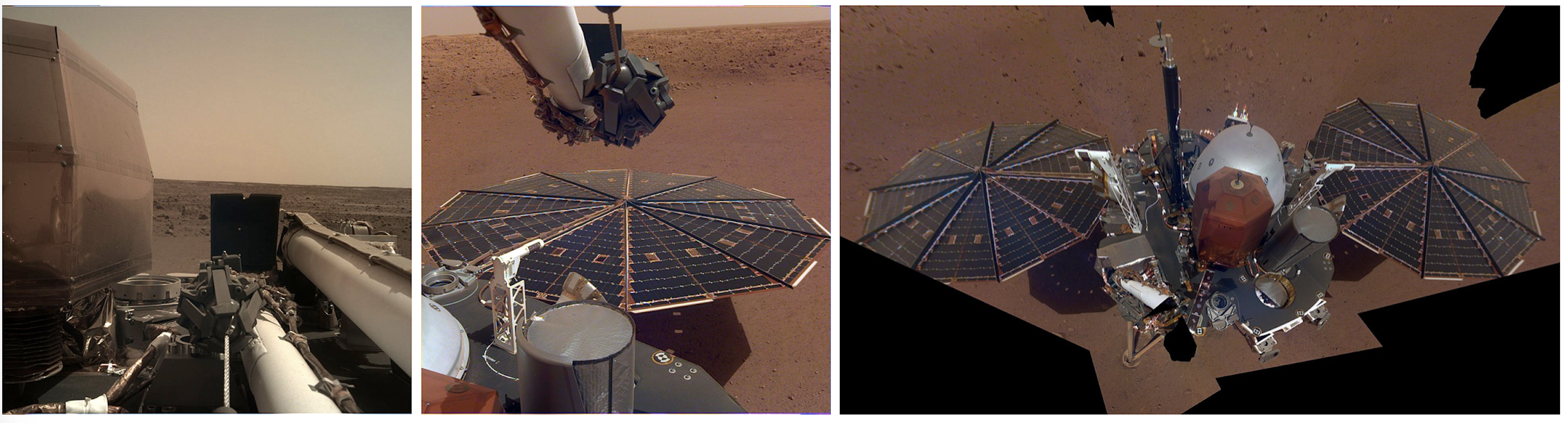
RISE is installed on Mars : The robotic arm in the folded position : One of the Solar panels deployed : Overall view of the probe.(© NASA).
Did You Know ?
Earth completes a wobble every 18 Earth years as it is pushed and pulled by the Moon. Mars completes a wobble every one Mars year (two Earth years). RISE will tell us exactly how much Mars wobbles, using the same technology that your smartphone uses to tell you your location.
The first data !The NASA team regularly tests the instruments :
Data transfer, OK! Communications, OK! Perfect, everything is ready to collect data !
SEIS
As soon as it was installed SEIS picked up “microseisms” generated by Martian winds creating low-frequency waves at the surface. However on April 6 SEIS picks up its first marsquake.
The rumbling noise that we hear in this clip is this first Martian earthquake, a “marsquake”, which appears to originate inside the planet.
This video illustrates a Marsquake detected by InSight on April 6, 2019, the 128th Martian day of the mission. 3 distinct kinds of sounds can be heard, all of them detected as ground vibrations by SEIS : -1-There's noise from Martian wind; -2-the seismic event itself; and -3-the spacecraft's robotic arm as it moves to take pictures. (© NASA/JPL-Caltech/IPGP/DRL).
Sounds of Mars: NASA’s InSight Senses Martian Wind (© NASA/JPL-Caltech/IPGP/DRL).
HP3
Since February 28, 2019 HP3 has been blocked by stones at a depth of 30 cm. The probe could be blocked by “a rock or gravel,” according to a statement from NASA.
On June 5, 2019, JPL and DLR researchers decided to move HP3 using InSight’s robot arm to allow it to bypass the rocks that block its progression in the ground.
On the left of the photo, HP3 is raised revealing one end (© NASA/JPL-CALTECH).
Hurry! Move on to adventure 5 and discover more details about the red planet!
Quiz!
Validate your knowledge!
Game
Do a scientific expedition to a comet!Have fun with the knowledge you have gained!
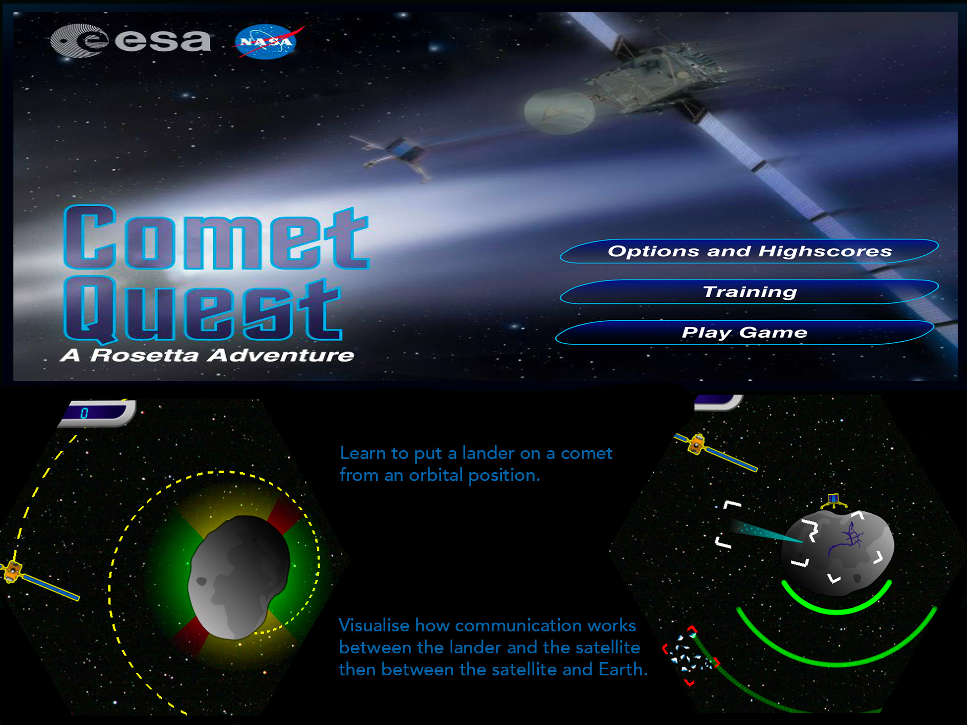

Game
This game doesn't seem to work for your computer but you can try the following game if you have an iPhone :

Previous adventure
End of mission

Next adventure
We would like to thank :
Paul Denton
Denton Seismo Ltd UK,www.dentonseismo.co.uk
English translation
Nadine Beyeler and Laurence laffargue-Rieder
German translation
Philippe Labrot
IPGP, Institut de Physique du Globe de Paris, France
Scientific advice
Philippe Lognonné
IPGP, Institut de Physique du Globe de Paris, France
Scientific advice
Philippe Laudet
CNES, National Centre for Space Studies, France
Scientific advice
William Bruce Banerdt
JPL, Jet Propulsion Laboratory, Pasadena, CA, USA
Scientific advice
Credits : IPGP, NASA, JPL, CNES, CEA, ETH Zurich and University of Zürich
